
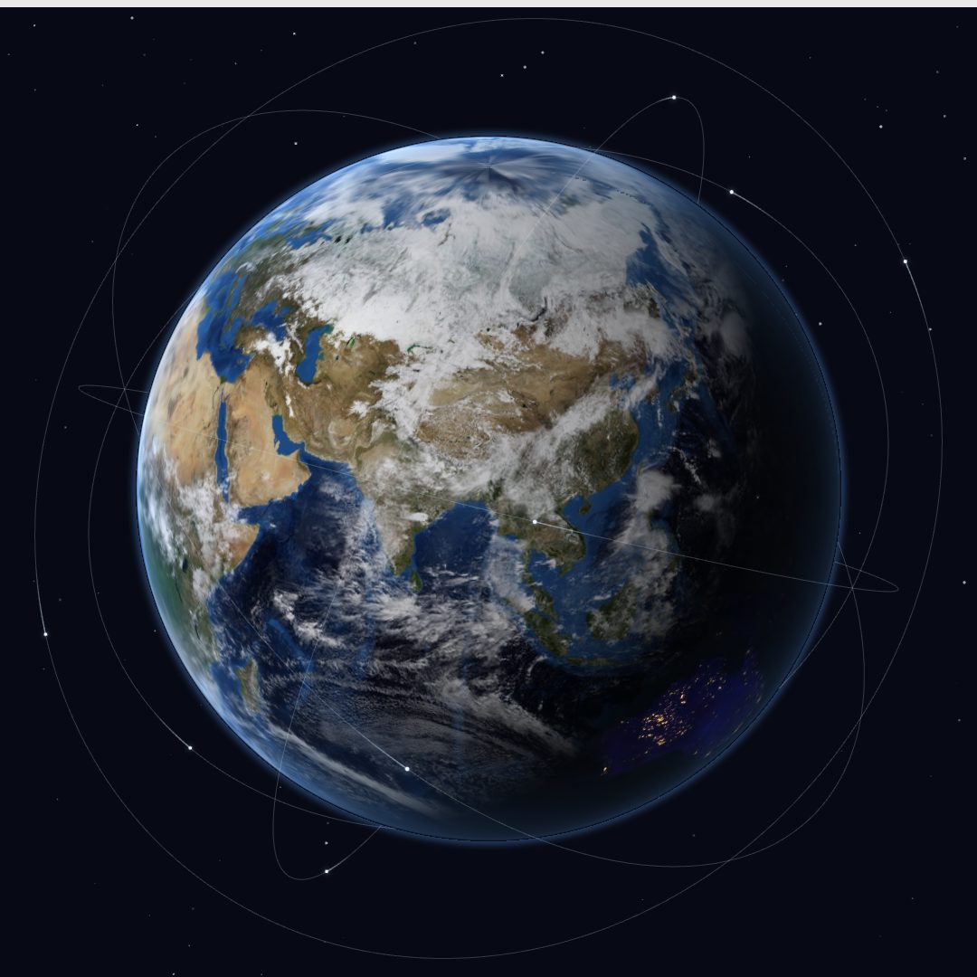
Earth observation for planning and response
Satellite insights.
Ready for action.
Powered by Japanese satellite technology. Grounded in real-world expertise.
TerraWatch turns satellite data into practical insights for everyday planning and disaster response — so you can see what is changing, and decide what to do next.
Overview
From everyday planning
to urgent disaster response.
TerraWatch brings together satellite analysis, open geospatial data and consulting expertise, and delivers what a region looks like — and what has changed there — as information you can decide on.
It shows the flood and landslide extents published by agencies such as UNOSAT and the Copernicus Emergency Management Service, and the synthetic-aperture radar (SAR) analysis shared through Sentinel Asia, with population, building and road data underneath. From land-use mapping to disaster assessment, satellite data becomes information the field can use.
Features
Satellite data, turned into
information the field can act on.
Satellite analysis and disaster-management expertise, from understanding the damage to prioritising support. We deliver information to guide the decisions disaster response depends on.
Get the insights you need — without having to ask.
We collect and analyse satellite data without waiting for a request, so your team can spend the first hours on the response rather than on finding and processing data.
Focus support where it matters most.
How many people are affected, and how much damage is expected. Affected population and estimated losses are shown by district, so you can decide where limited staff and supplies go first.
Beyond analysis. Guidance for your next move.
Settlements that need checking first, roads and facilities at risk. Our disaster-management specialists read the satellite analysis together with information from the ground, and turn it into decisions about what to verify and what to repair.
Understand the impact on people and infrastructure.
Satellite-observed damage is overlaid on geospatial data for population, buildings, roads and terrain. We are building that data region by region, to show how far the damage extends and what it reaches.
Which disasters we cover, and how far the support goes, depend on the data available and on what we agree with the agencies involved.
Screens
Which areas need support?
Which roads and facilities need checking first?
In disaster response you need to know where the damage is, how large it is, and what to do next. TerraWatch overlays population, building and infrastructure information on satellite analysis to deliver information you can use for field checks and for deciding where to send support.
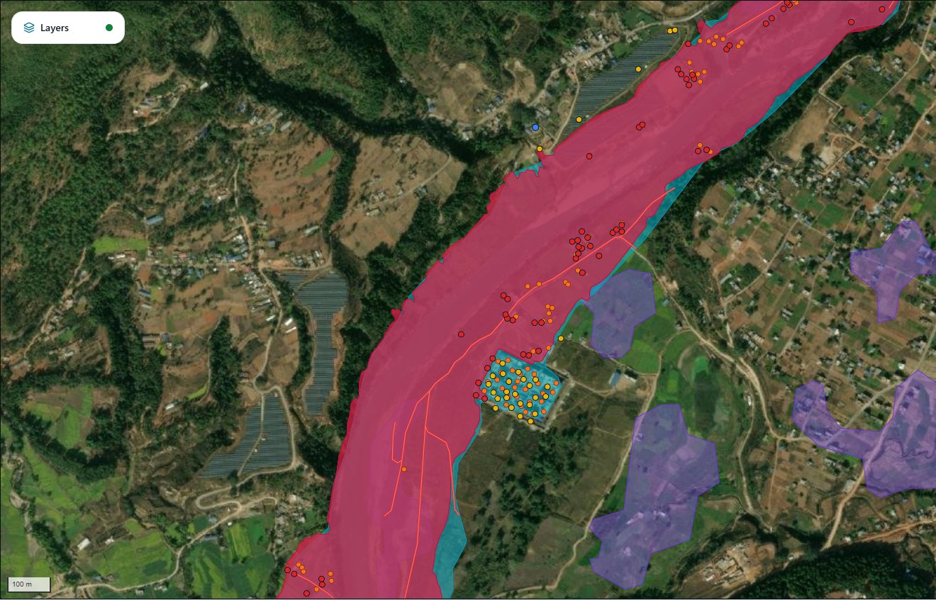
See which areas may be affected.
Settlements, buildings, roads and critical facilities are overlaid on flood and landslide extents. Identify the settlements inside the affected area and the roads and facilities at risk, and narrow down where to contact and check first.
What you can check
- How far the affected area extends across your district
- Which settlements and buildings fall inside it
- Where the roads, hospitals and schools that need checking first are
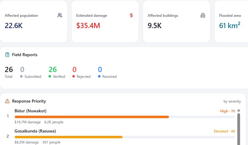
Decide where to send people and supplies.
Compare affected population, number of buildings and estimated losses by district. Check the scale of damage together with response priority to decide where to send support and how to allocate staff and supplies. It also serves as shared evidence when briefing other agencies.
What you can check
- Which districts are expected to have many people and buildings affected
- How large the estimated losses are in each district
- Which districts to consider responding to first
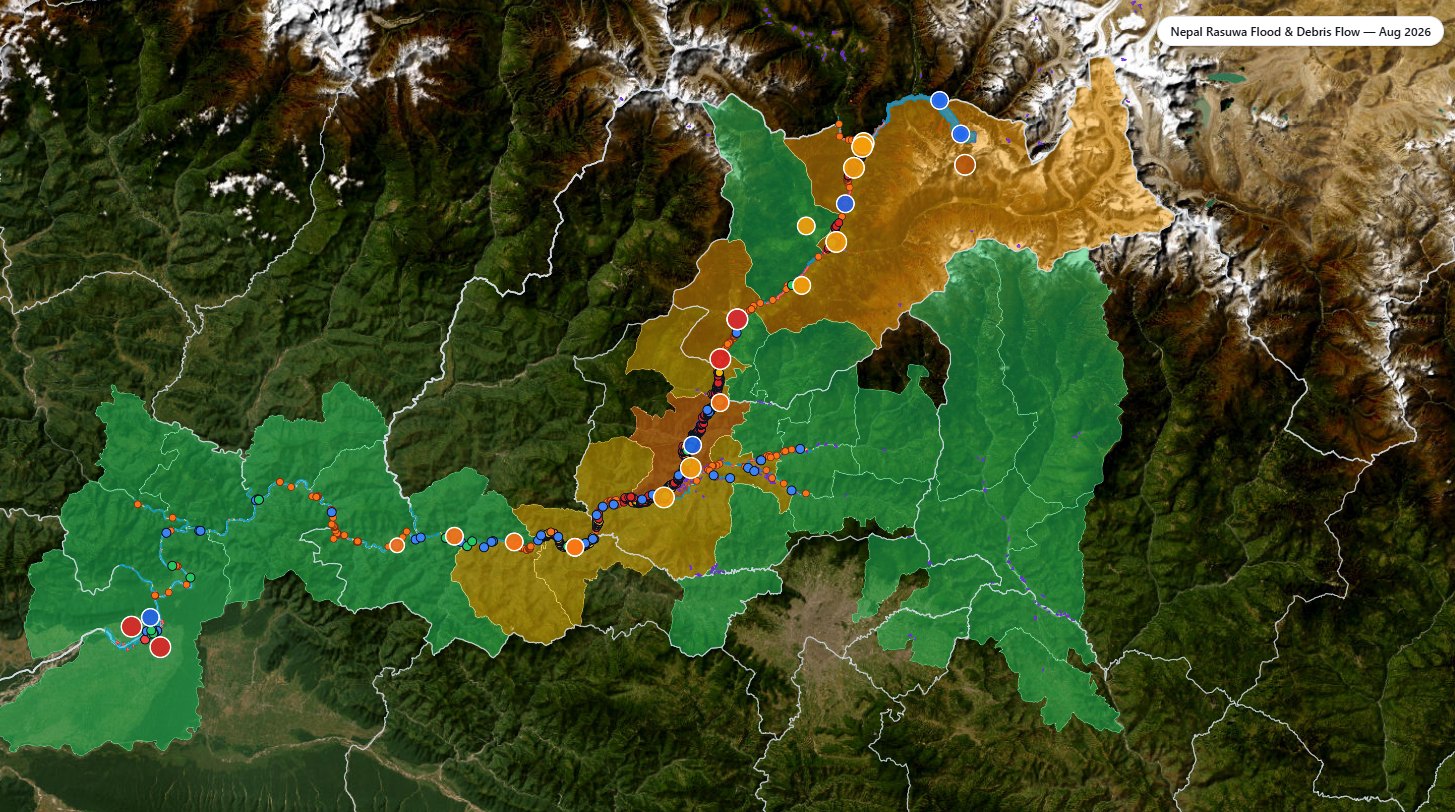
See what's happening on the ground.
Open a report point on the map to see the photo and the description. Damaged buildings, cut roads and the other things satellite analysis alone cannot show are filled in, and the points that need another look are marked. Headquarters and the field share one picture of where and what.
What you can check
- Where damage is reported, and of what kind
- What the photo tells you about conditions on the ground
- Whether a report has been verified or needs further checking
The screens show a case reconstructed after the event. Affected population, losses and response priorities are estimates offered for reference. Whether a road is passable and whether a facility is operating have to be confirmed from the ground. Some field reports are compiled from public sources such as news coverage.
- Case study: Nepal — Rasuwa District flood, August 2026, reconstructed from published data after the event.
Services
Satellite analysis services
Beyond disaster response, we provide analysis services based on satellite data.
- Disaster impact mapping
- Forest-fire monitoring
- Ground-deformation monitoring
- Land-use mapping
- Land-use change projections
- Crop mapping
Contact
Let's put satellite insights to work.
Tell us about your region, your challenges and the decisions you need to make. We'll help you explore how TerraWatch can support your team.
Both buttons open your e-mail app with a message you can fill in.
For disaster-management agencies, local governments and international cooperation organisations, and for companies considering providing or integrating satellite data.
TerraWatch is operated by Oriental Consultants Global (OCG), a Japan-based engineering consultancy.Company